- Previous project: Campus de la Faculté de Jussieu – Bibliothèques
- Next project: Aménagement des bords de Seine – SEMNA
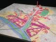
Banks of the Seine Development – SEMNA
- Nanterre, France

The Essential Balance
For centuries, and the past few decades even more so, all the major urban policy decisions involving Paris and its suburbs have been made at state level and then imposed on so-called suburban councils.
It’s an understatement to say that, in hindsight, many past decisions have been based on errors of analysis and forecasting (the 1960s master plan, for example, which forecast a Paris of 20 million inhabitants by the end of the century – whereas, excluding the grands axes, the new towns and the built-up suburban belt, there will actually only be about 11 million of us…).
A logic of juxtaposed built hubs and out-scale urban development became the rule as a result.
The announcement of a future new town for the north of Paris demonstrates that awareness of past errors is rather hazy and that, in spite of the policy of decentralisation, the Paris agglomeration remains the place where the central decisions are made.
The case of Nanterre is significant.
No one can deny that work of this importance should be conducted in a spirit of respect for the towns concerned and should be opportunities for some kind of improvement in the inhabitants’ living conditions, without adding to the prevailing chaos in terms of discontinuity of land use, environmental nuisances and disruptions to the built environment.
To avoid a situation where, yet again, the big decisions are made basically in accordance with the stakes for the central power, the City of Nanterre, well-versed in the complexity of urban parameters, has asked me, as an urbanist architect, to come up with a proposal based on an essential balance between harmonious development of Nanterre and the resolution of external constraints.
This proposal is not aimed at automatically going against what are presumed to be the main state options, but it is all for securing the future and identity of Nanterre.
The example of the so-called historic axis is typical.
Extending the Champs Elysées from Ferdinand Lop all the way to the sea is a nonsense: the geographical relief of the terrain and the slab of La Défense make this ‘axis’ impossible to see.
On the other hand, a certain development logic has been defined. The Arche is a landmark. There are vacant lots precisely along this axis.
Reversing the principle: instead of making the axis a cut-off point, coming from Paris, for a motorway or an avenue, we could bring in the water and vegetation to enhance the university and housing by expanding the leisure centre. Creating an identity and boosting awareness of place mean using the location’s specific features – here, the presence of the Seine and the opportunity presented by land that’s still virgin.
A city is made by concretion, by stratification over time. Every era of its build-up is worthy of respect.
The very worst thing we could do would be to use today’s buildings as a foil. Each building we propose is intrinsically related to an existing environment.
I’d like to put forward an urban rule based on the creation of microclimates: the new apartment blocks become the built boundary of inner worlds where yesterday’s and today’s architecture face off in a friendly dialogue, spurring opportunities for diversity, discovery, and surprise.
The leisure centre, where the vegetation is protected and extended along the canal to the Parc André Malraux, becomes a link between the different precincts. The use and density of any new buildings erected in the areas inevitably slated for redevelopment have yet to be specified, but what we do know is that only these built surfaces will allow us to solve the problems tied in with the external constraints.
This project is at once a message in a bottle thrown in the Seine and a helping hand reaching out to all those who’d like to endow this Greater Paris precinct with the complexities, contradictions and surprises that produce the spirit of a place.
Jean Nouvel